Tawas Birding
Tawas Birding
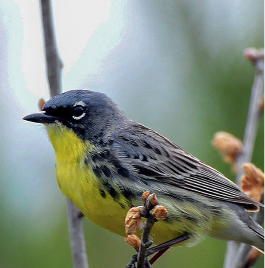
Enjoy some of the best birding in the Great Lakes region. Tawas Point and surrounding areas are known worldwide for having more than 200 species during peak migration times and high concentrations of migrating warblers. Tuttle Marsh WIldlife Area is a birder's paradise only seven miles north of town. Bald eagles, Trumpeter swans, Piping Plovers and Kirtland Warblers can be sighted in many areas of Iosco County and along the newly dedicated Sunrise Coast Birding Trail.

Annual Tawas Point Birding Festival
AuSable Valley Audubon
Beginner’s Guide to Bird Watching
HomeAdvisor
Tawas Point Migration Days 2023
May 12-13, 2023
An adventure with AuSable Valley Audubon
16th Spring Birding Event
Tawas Point State Park, Michigan. Birding and Photography volunteers will be available at Tawas Point (Free to all) 8 a.m. – dusk on Friday & Saturday. Information will be available for birding spots including Hale, Oscoda, Tawas City, and East Tawas, such as Tuttle Marsh, Iargo Springs, Lumberman’s Monument, and the Scenic River Road Byway. A Bird sighting list will be on display near the lighthouse trailhead on Friday & Saturday and a shorebird identification station will be set up on the South shore of the point. For details, visit the AuSable Valley Audubon Facebook page, Bill Roth 989-387-5980 or Amy Kohlhepp 517-489-7879 or our tent at the Park.
What to Expect:
Bird sightings — Tawas Point is a natural birding hot spot in the Spring as migrating birds follow the shoreline to Summer nesting habitats. Songbirds, waterbirds and raptors all may be seen in this location and throughout Iosco County, mostly in May. Birders come from all over the world to bird this location, some can routinely can find over sixty species of birds in a single day.
AuSable Valley Audubon members and friends will be at the park to help newer birders by:
* Providing maps to local birding hot spots and birding trails
* Help track unique sightings on a white board
* Share information about local amenities
Watch for AVA Volunteers and friends of AVA, who will be wearing a blue vest; some may help with bird identification, commonly used phone apps like E-bird and Merlin or even photography assistance per their level of expertise.
Migration Days: Guided Tuttle Marsh Birding Walk (Saturday, 5/13 at 7:30 am)
If you are going to participate at Tawas Point Migration Days then you may want to visit nearby Tuttle Marsh. You can join a Forest Service ranger for an early morning stroll to enjoy the abundance and variety of birds stopping in on their way North.
Required registration starts on May 5th, by calling (989) 362-8961. Spots are limited to 20 people and if space is available then you can register at the AuSable Valley Audubon, Bird Migration Day's Welcome Tent on Friday, May 12th. The meeting location for the Tuttle walk will be shared at registration; and for this walk, bring your own binoculars. An additional walk may be offered, based upon demand.
Tawas Point Migration History
Tawas Point, located on the Northeast Michigan shore of Lake Huron is a natural birding hot spot in the Spring as migrating birds follow the shoreline to summer nesting habitats. Songbirds, water birds and raptors all may be seen at this location and throughout loco County principally in May.
Since 2006, AuSable Valley Audubon has hosted a Spring birding event to celebrate nature with fellow birding enthusiasts. This event has attracted participants from across the US and internationally.Michigan Audubon promoted and organized this event for many years. The expertise provided and their depth of involvement with the local chapter was a huge influence on its continued success.
Since 2018 the local chapter, AuSable Valley Audubon has been the sole organizing entity. The present event at Tawas Point State Park offers casual birding for birders of all levels. Participants will find friendly and helpful local birders available at various key areas to interact one-on-one and to answer questions about local amenities, other nearby hot spots, and bird identification.
Sunrise Coast Birding Trail
The Sunrise Coast Birding Trail incorporates 145 miles along U.S. 23. The trail takes flight at the mouth of the famed AuSable River in Oscoda and wings its way north all along the Lake Huron coast to Mackinaw City.Birders will delight in observing the common, threatened, or endangered birds of Michigan’s coastal and inland locations. The Audubon chapters with the help of Consumers Energy and the Northeast Michigan Council of Governments developed a four-color map showing the route and birding locations. A copy can be downloaded from the trail website.

Sunrise Coast Birding Trail
Michigan Audubon
Birding Maps
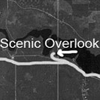
Self-guided tour of Scenic Overlooks for Bald Eagle Viewing
From US-23 in Oscoda, turn at traffic light on River Road in the middle of town. Go west 8 miles to the scenic overlook of Foote Pond. Next, proceed 6 more miles west to Lumberman's Monument overlook. Next, approximately 2 miles further west on River Road is the Canoer's Memorial overlook. Another 0.5 miles is the Iargo Springs overlook. Finally go 1.5 miles west to the end of River Road and turn left onto highway M-65. Go 4 miles to the Westgate overlook, which has two viewing platforms.
In the spring of the year it is possible to witness courtship flights by Bald Eagles. In these displays the mates fly together from opposite directions, grasp talons, and plunge in a spiraling dive towards the water below. With their feet locked together and wings set, the eagles can reach high speeds. More than once, caught up in the moment, the eagles have failed to release their mates and plunged to their deaths.
The AuSable River valley contains 19 active bald eagle nests.
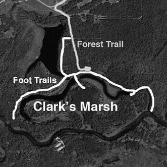
Self-guided Birding at Clark's Marsh
From Oscoda, Michigan, take F-41 north to Skeel Avenue, turn left onto Parimeter Road. Go straight to edge of runway. Continue on pavement and turn left onto forest trail that parallels chainlink fence. Go south ¼ mile to parking area at end of trail.
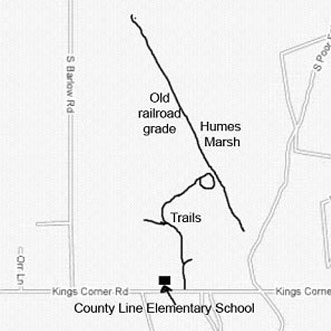
Humes Marsh
From the south: go north to Oscoda and go to the second traffic light, which is the intersection with F-41. Go left on F-41 for several blocks to a traffic light at the intersection with Cedar Lake Road. Go right (north) 5.3 miles to the end of Lakewood Shores Golf courses. Turn left (west) on King's Corner Rd. Go 1.2 miles to County Link Elementary School parking lot. Group will drive to Humes Marsh from there.
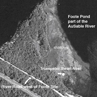
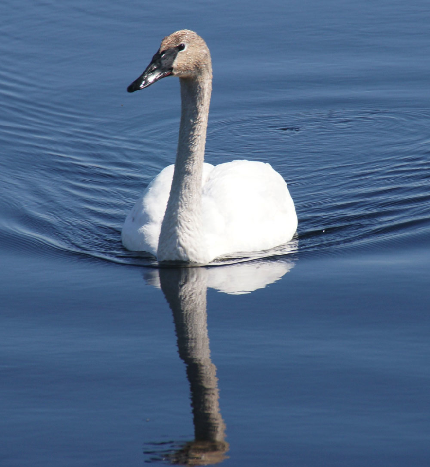
Self-guided Birding to Trumpeter Swan Nest
From US-23 in Oscoda, Michigan, turn at traffic light on River Road in the middle of town. Go west 6 miles, just past the village of Foote Site. At the Foote Site Park, go to the west end beyong the boat launch ramp. The swan nest island is in shallow water about 100 yards from shore.
Please do not feed the swans. however, they are curious and seem to be very comfortable around people. Should you invade their space, the male Trumpeter will challenge you.
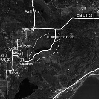
Self-guided Tour of Tuttle Marsh
From US-23 in Tawas, turn west onto M-55 and go approximately 0.5 miles to Wilber Road and turn right. Go 5 miles north to Galion Road & turn right. Go 0.5 miles to Old US-23 and turn left. Proceed north 1.5 miles to May Road. Turn right onto May Road. Go 0.5 miles to Brooks Road and turn right. Go 0.25 miles on Brooks which turns into Davidson Road. Continue going east on Davidson until the intersection with Tuttle Marsh Road and turn left.
The following 7 miles is a mixture of wetlands and dry uplands. The ponds along both sides of the road contain a variety of wildlife. Once you come to the impoundment, the ponds on the right have the greatest variety of wildlife.
Birding & Watchable Wildlife
Tawas Point State Park
Tawas Beach Road, East Tawas
This is a geographical feature that can be seen and recognized from space with the naked eye! Excellent migrating bird area in spring, great for shore birds as well.
Tawas Lake
Tawas Bay Shoreline
Along US-23. Eagles, swans, and variety of waterfowl. See Purple Martin houses along the highway as well as Chimney Swifts in Tawas City.
Three Mile Beach Park
Corsair Skiing & Hiking Trails
River Road Scenic Overlooks (Bald Eagle viewing)
Tuttle Marsh Wildlife Area
In Wilber Township, site of the first Ducks Unlimited project in Michigan. From your car, view an assortment of songbirds and waterfowl at impounded ponds. Osprey nesting in the area.
Eagle Run
Lumberman's Monument
Iargo Springs
Au Sable River & Au Sable River Mouth Area
Along River Road, west of Oscoda and at Lake Huron beach along US -23. Bald eagle, trumpeter swan and Caspian Tern frequent the area as do other waterfowl and songbirds.
Au Sable Shoreline Park
Oscoda- Au Sable Chamber of Commerce Office, south of the bridge on US -23. Enclosed bird-viewing platform with a paved walkway down to the shore of Lake Huron.
The Jack Pines @ Rollway Road
(Kirtland Warbler nesting area)
Foote Pond
West of Oscoda, on River Road. Numerous species of ducks plus Trumpeter Swans' nest.
Clark's Marsh Foot Site Park (Trumpeter Swan Nest)
Oscoda, on edge of former U.S. Air Force property, wooded area along ox-bows of Au Sable River, impounded ponds offer a variety of waterfowl and woodland birds.
Sandy Hook Nature Trail
Loon Lake Nature Area
M-65 just north of Hale a mile on the left at the Lutheran Camp. Has a nature trail with a boardwalk connecting Loon Lake to Mud Lake, a boat launch, picnic area, bathroom, and drinking water also available. Loons, Kingfisher and water birds and woodland birds abound in the area.
Huron Manistee National Forest
